Experiencing Siachen War ( Part 3) By: KEVIN FEDARKO

NOTE:   visit     www.techenlife.com       for more details regarding this blog and military aviation!!


“We never keep track,” one captain who had served there told me, “because if one counts, he completely forgets himself.” Tabish was established during a brutal firefight in September 1987, when the Pakistanis lost a crucial high post known as Qaid, then failed to push the Indians off the neighboring ridge. Last spring, when Captain Safdar was there, Tabish’s problems were aggravated by an avalanche of rocks that damaged several bunkers. Safdar apparently acquitted himself well during this crisis.

“Your leadership was exemplary,” the C.O. announced. “Young officers like you are the reason why we continue to dominate the enemy. Officers like you are the reason why we will ultimately prevail in this war.”

Life at such forward positions is brutal, and the Indians begrudgingly admit that the Pakistanis are tough customers. “They are sitting right underneath us on an 80-degree slope,” one Indian officer who was stationed above Tabish would tell me later. “We can throw grenades just like pebbles on top of them. It really takes guts to be there.” Captain Waqas Malik, 26, who served at Tabish, grimly described the hopeless feeling of such positions. “Once a ridge has been occupied,” he said, “you require a heart with the capacity of the ocean to accept the casualties you will incur in the taking of it.”

Each high post is manned by a squad of six to 18 men commanded by a young officer, usually a captain, and space is tight—a couple of fiberglass igloos, machine-gun platforms, a latrine, and a tiny area for religious worship. Each soldier is in charge of a particular weapon: light machine guns (LMGs), mortars, anti-aircraft guns. The men stay out of sight by day and stand watch by night.

Indian soldiers

Unlike mountaineers, who usually climb during the best weather, Siachen soldiers endure the worst the mountains can throw at them, year-round. Avalanches are frequent and terrifying; their thunder is so great that it’s often impossible to distinguish from shelling. Blizzards can last 20 days. Winds reach speeds of 125 miles per hour; temperatures can plunge to minus 60 degrees. Annual snowfall exceeds 35 feet. During storms, two or three men have to shovel snow at all times. If they stop, they will never catch up and the post will be buried alive.

“Sometimes in the winter, you see nothing but white,” said Captain Jamil Salamat, 24, the medical officer at Ghyari. “And you think, Maybe I will never make it back. That is the hugeness, and the hugeness has its own effect. It’s overwhelming. The snow is like an ocean up there.”

In such extreme cold, the single most important resource is kerosene. Known as “K2 oil,” it is used for cooking, melting snow for water, thawing out frozen guns, and keeping warm. It gives off a noxious smoke that coats the igloos with grime; for months after they descend, soldiers cough up black gunk.

Survival under these conditions requires specialized equipment. There are 112 separate items in a Pakistani soldier’s high-altitude kit, including two types of oxygen canisters, three models of ice axes, three kinds of rope, 29 sizes of pitons, five different pairs of gloves, three types of socks, a puffy white down suit rated to minus 60, and a black plastic”nuclear-biological-chemical warfare face mask.” The Pakistani gear that I saw seemed to be generally low-quality stuff; most of it carried the brand name Technoworld, which no one I spoke to in the outdoor industry had ever heard of. In contrast, Indian soldiers get state-of-the-art gear from a wide range of highly specialized Western firms like Koflach, Asolo, and Black Diamond

Pakistani gunners

The monetary cost of these posts is enormous. A liter of kerosene that goes for 19 rupees in Rawalpindi costs Pakistan more than 650 rupees by the time it’s been hauled to 19,000 feet. (On the Indian side, almost every pound of supplies, including the artillery pieces, is flown in by helicopter because there are no roads on the glacier, pushing transportation costs ten times higher.) Each summer in the Ghyari sector alone, more than 35 Pakistani bases, gun positions, and fighting posts have to be stocked with some 2,000 tons of ammunition, rations, and fuel. This material is freighted to Ghyari by truck and hauled up the ice on mule and donkey trains. To prevent snowblindness, the pack animals are equipped with specially made glacier goggles. Sometimes they stumble and plummet into the crevasses. “They scream for an hour until they freeze to death,” one of the muleteers told me. “It is terrible to hear.”

Over 90 percent of the casualties on both sides are caused by weather, terrain, and what mountaineers call “objective dangers.” Above 18,000 feet, the human body cannot acclimatize and simply starts to deteriorate. Soldiers fall ill, lose their appetites, can’t sleep, and have problems with memory. Severe frostbite—all it takes is touching a gun barrel with bare hands—can result in the loss of fingers and toes. The two most serious killers are HAPE (high-altitude pulmonary edema) and HACE (high-altitude cerebral edema). Men suffering from HAPE, an accumulation of fluid in the lungs, cough up a pink froth and can be dead in a matter of hours. With HACE, fluid leaks from oxygen-starved blood vessels in the brain, causing severe swelling, headaches, hallucinations, and dementia. Untreated, HACE can kill a man within 24 hours.

Pakistani soldiers on their way to a top post

In settings like this, suffering is often transformed into legend. The Pakistanis tell of a post beyond Sia La, at nearly 22,000 feet, that is said to have three separate cracks in the ice known as Three-Man Crevasse, Five-Man Crevasse, and Eight-Man Crevasse—each named for the number of men who died falling in. Soldiers talk of men losing their minds and leaping from the posts to their deaths. Some say their tormented cries can be heard in the wind over the peaks. And then there’s the story about the platoon killed in an early battle at Bilafond La, whose bodies froze into such grotesque positions that their corpses had to be hacked into pieces before they could be placed in helicopter panniers and brought down for return to their families.

Whether such tales are true is less important than what they symbolize about the futility of Siachen duty. “From what I’ve read, no one has ever been stupid enough to fight at this level before,” an officer at Ghyari remarked one afternoon when none of his colleagues were within earshot. “I hope it won’t be repeated again, because it’s a waste. A big, bloody waste.”

THE ARTILLERY FIRE HAD BEEN so fierce during the summer of 2002 that the Pakistani top brass delayed our trek to the front. But on our third day at Ghyari, they gave the go-ahead: We would be escorted by a squad of eight soldiers who had been ordered to relieve Captain Yasin Rafiq, the commander of a post called Sher.

the snow is like ocean up there. snipers eye view from SHER POST Pakistan

Sher is perched at 19,600 feet on a ridge at the head of the Chumik Glacier, a short, steep tributary that comes crashing down into the Bilafond Glacier from the northeast and is one of the few Pakistani positions on the Saltoro that commands the high ground. It took us three days to hike there. On the third day, we reached a field of metal shards from exploded Indian artillery shells. Soaring above us was a huge crescent-shaped saddle. To get to its crest—where we could see the tiny black spot that was Sher—we had to ascend a thousand-foot snow-and-ice wall, pulling ourselves up on fixed ropes.

At the top, we caught our breath beside an 81mm mortar tube, then stepped into the post itself. Sher is only about 12 feet wide and 40 feet long. On one side are two fiberglass igloos where the men eat, cook, and sleep. On the other are a hulking 14.5mm Chinese-made anti-aircraft gun, a machine-gun bunker, and, higher up the ridge, a tiny observation post. We hobbled across 12 feet of frozen mud, stepped up to a stretch of rope serving as a guardrail, and stared down a 3,500-foot drop to the Indian front lines.

We were greeted by Captain Yasin, 29, who had been at his post for 82 days. Yasin pointed out an Indian supply base less than three miles away on the glacier below (from this distance, it was a brown spot on the ice), an Indian seasonal observation post (which we couldn’t see), and an Indian helicopter route. He announced grandly that this was the first time foreigners had been permitted to visit Sher.

Pakistani soldier offering prayer

Above the post, the ridge rose to a massive double peak called Naveed Top. In April 1989, the Indian army launched a mission known as Operation Ibex; its aim was to capture this peak and force the Pakistanis to vacate the entire upper portion of the Chumik Glacier. Three teams of Pakistani soldiers attempted to reach the summit to thwart the Indian operation and failed; one team was wiped out by an avalanche, the others halted by overhanging seracs. A last-ditch decision was made to airlift troops to a point just below the top of the 22,185-foot mountain using French Lama helicopters designed to fly no higher than 21,000 feet.

The air was so thin, the pilots feared they would crash if they attempted to hover. So after stripping as much excess weight as they could, they used a maneuver called a “running drop,” which required an individual soldier dangling from the bottom to be dropped onto the peak as they passed over. The first to make it was a 29-year-old lieutenant named Naveed-ur-Rehman. He was soon joined by a sergeant named Mohammed Yakub. But then a storm blew in and both men were forced to huddle on the mountain without supplies for two nights.

“The wind was so strong,” Naveed, who is now a major, later told me, “that we had to dig in our heels to avoid being carried away.” Over the next 40 days, six choppers relayed 86 soldiers and 38 tons of supplies onto the peak. Two Pakistani soldiers died and 30 were wounded during the defense of Naveed Top. That May—after the Indian advance was halted by a massive avalanche that killed a large number of their troops—both sides agreed to demilitarize the summit.

Or so say the Pakistanis. To this day, the Indian army denies that any of this ever happened.

Pakistani gunners making life miserable for indians

That evening, after the sun went down, the men at Sher all crammed into the largest igloo for what Captain Yasin called “after-dinner discussion.” It began with the sergeant, or havildar, thumping out a beat on an empty jerry can using a carabiner. The men began singing in Pashto, while Yasin—who is a hafiz, which means he has memorized the entire Koran—translated for me. It was a song about the cruelty of beautiful women, he said, about the rigidity of their hearts and the shallowness of their sincerity. Then the men shifted to Urdu, the language of the Mogul poets and Sufi mystics. They sang of how the affection between men and women has the power to transcend social caste. They sang about an aspect of love so complex and subtle that Yasin said it was impossible to translate and advised me to just sit back and enjoy the music.

After the singing stopped, Yasin and I stepped outside. The moon was surrounded by a rainbow-colored ring, harbinger of a storm, and the peaks were cast in a milky glow. From the shadows came a disembodied voice in Urdu.

“Beautiful night, sir.”

“Mehboob, is that you?” said Yasin to a lone sentry who had volunteered to stand watch so that his companions could hobnob with the guests.

Experiencing Siachen War ( Part 2 ) By: KEVIN FEDARKO

NOTE:   visit     www.techenlife.com       for more details regarding this blog and military aviation!!


Those five ambiguous words were a ticking time bomb. In the spring of 1984, after three decades of cross-border hostility, armies from both countries raced to seize two key passes on the Saltoro Ridge, which originates not far from NJ9842 and forms the western wall of the Siachen. Since then, the war has been fought largely in secret, its front lines rarely observed by outsiders or foreign journalists. All along the Saltoro Ridge, Indian and Pakistani soldiers have erected between 120 and 150 outposts perched at elevations ranging from 9,000 to 22,000 feet. The locations of most of these, their routes of access, even their names, are closely guarded secrets. The total number of combatants is unknown, but probably falls between 8,000 and 10,000. The death toll is also classified, with estimates ranging between 2,500 and 4,000 killed since 1984. The cost of the war is murky, too; together the two countries are estimated to be spending between $182 million and $438 million a year.

Here’s what is beyond dispute: Never before have troops fought for such extended periods in such extreme physical conditions. At least twice a week a man dies, occasionally from bullets or artillery, but more often from an avalanche, a tumble into a crevasse, or a high-altitude sickness—perils usually faced only by elite climbers. Not surprisingly, the men who serve in the war regard it as the supreme challenge for a soldier.

“Minus 50 at 21,000 feet—it’s beyond anything the human body is designed to endure,” an Indian officer on the Siachen told me. “This is the ultimate test of human willpower. It’s also an environmental catastrophe. And—no doubt about it—things can only get worse.”

LAST AUGUST AND SEPTEMBER, after securing access from the Pakistani and Indian armies, Teru and I trekked to both sides of the Siachen conflict to get a look at this highest and most hidden of military standoffs—the first American journalists to do so on foot. It was a tense time. Islamic militants had bombed the Indian Parliament in New Delhi the previous December. By the summer, a million troops were deployed along the border. When we arrived in Pakistan, British and American diplomats had just succeeded in getting the two countries to step back from the brink of a nuclear exchange.

Pakistani soldiers packing for their journey

Our journey began in Khapalu, a town on the Shyok River, where we met Major Mohammed Tahir Iqbal, the second-highest-ranking officer at brigade headquarters for Pakistan’s Siachen operations. The major greeted us in his office, then took us outside to view a concrete scale model of the entire Siachen theater. “Our objective is to foil the Indian designs,” he explained, waving a long bamboo stick to point out various features of the model. “We are just trying to maintain operational readiness so that they do not think of any further mischief.” Easy enough to say, but by almost any measure—military might, economic clout, political stability, population—India is more powerful than Pakistan. And it never lets Pakistan forget it. To compensate, Pakistani soldiers exhibit a spirited swagger, which can be fierce, comical, and endearing. Dressed in a tan one-piece uniform and speaking with clipped military precision, Tahir combined a little of everything as he clomped about on the Siachen model in his heavy black boots.

indian soldiers in a good mood near artillery gun

The model featured more than 100 white-capped mountains and ridges, blue rivers, and carefully labeled flags marking each army’s bases and posts. To the east and west stood a dense thicket of peaks divided by the two main rivers cutting through the region, the Indus and its mighty tributary the Shyok. There were few towns, roads, or bridges. Several glaciers were splayed across the map, the largest of which, by far, was the Siachen, which ran in a long diagonal line from northwest to southeast. Running parallel to the Siachen on its western side was a massive, virtually unbroken wall of peaks and escarpments. This was the Saltoro Ridge.

Looking at the impenetrable mountaintops, you could see why almost a century passed between the first report of the Siachen Glacier’s existence—by the British explorer William Moorcroft, in 1821—and its first survey, in 1912, by the American team of Fanny Bullock Workman and her husband, William. You could also see why climbers have been intrigued: Here, deep in the Karakoram, an entire sea of virgin peaks lay waiting to be bagged.

During the decade after the first ascent of Mount Everest, by Sir Edmund Hillary in 1953, virtually all the great peaks in the eastern Himalayas of Nepal were climbed, including Cho Oyu, Lhotse, and Dhaulagiri. Soon enough, mountaineers turned their gaze to the Karakoram, which contains four of the 14 highest mountains on earth—most notably K2, first summited by an Italian team in 1954. The door to the Karakoram was mostly shut, however, during the two wars that India and Pakistan fought over Kashmir in 1965 and 1971. Then, in 1974, Pakistan’s Ministry of Tourism decided to open the region again, issuing permits allowing foreign expeditions to climb on the Baltoro Glacier, near K2, and to explore the no-man’s-land around the Siachen

Pakistani soldiers playing cricket on he highest battle field

Between 1974 and 1981, at least 16 major expeditions climbed up to the Siachen and beyond—11 from Japan, three from Austria, and one each from Britain and the United States. Pakistan’s motive for issuing the permits, it seems, was a desire to promote mountain tourism. But as expedition reports circulated through the mountaineering community made clear, the foreigners had concluded that the Siachen belonged to Pakistan. This impression also took root in the minds of the Pakistani government, and today the list of these expeditions is often cited as proof of ownership. “Our contention,” Tahir told me, waving his stick, “is that this is our area.”

India says the same thing, and both sides are unwilling to admit that neither has a solid legal claim to the region. (To avoid being dragged into the conflict, the United States has steadfastly refused to take a side.) Robert Wirsing, a professor at the U.S. Navy’s Asia-Pacific Center for Security Studies in Honolulu and one of the world’s leading experts on the dispute over Kashmir, puts it more bluntly. In his view, the claims of both sides are equally spurious. “The Indian arguments are absolutely 100 percent false, and so are Pakistan’s,” says Wirsing. “The Pakistanis have no right to base their claim on permits issued to foreign mountaineers. And the only strength to the Indian argument is that it’s backed by a force that cannot be dislodged.”

Pakistani gunners aiming at indian positions

Neither side is budging, but judging from Tahir’s map, the Pakistanis definitely face an uphill task. The entire Saltoro Ridge, including the two highest passes that connect Pakistan to the glacier—Bilafond La at 18,200 feet and Sia La at 18,850 feet—is bristling with red flags: Indian army posts. On ridges running parallel but at significantly lower elevations, you see a corresponding belt of blue flags: the Pakistani posts.

Tahir reluctantly conceded that the Indians own the high ground, but insisted that Pakistan has “better communications, better roads, and better motivation.” And that wasn’t all.

“Morally,” he said, bringing the tutorial to a close, “we occupy the high ground.”

TO REACH THE FRONT LINES we drove along the Shyok, then headed deep into the mountains to a village called Dansam, a hub for roads leading to the major Pakistani combat sectors. Our destination was a base called Ghyari, which is lodged at 12,400 feet in a narrow valley leading up to Bilafond La. We arrived on an August evening under a canopy of stars, coming to a halt beneath a wooden marquee emblazoned with the words GUARDIANS OF THE FROZEN FRONTIER.

Ghyari sits between soaring granite walls as bold and majestic as El Capitan, threaded with waterfalls that turn to mist before they hit the valley floor. Farther up this valley lie several Pakistani artillery batteries, which lob shells at the Indian posts dug in on the ridges above. Ghyari is a supply center and rehab station for worn-out soldiers—they recuperate after coming down from the front, or pause to acclimatize before marching up to relieve their comrades, who are rotated out every two to eight weeks to prevent high-altitude sickness and brain damage.

Indian helicopter dropping supply

The Ghyari base consists of a dozen neatly whitewashed buildings and a 600-year-old mosque established by Sayyid Ali Hamadani, who introduced Islam to Baltistan in the 14th century. A few steps from the mosque sits an underground bunker that serves as a studio for a young man named Makhtar, who paints portraits of the shaheeds, or martyrs—soldiers who have been killed in this war and thereby gained admission to paradise. The Pakistanis believe their religious faith gives them motivation that the Indians lack. “The concepts of jihad and shahadat—or Ôlife after death’—help us strike hard,” explained Major Sikendar Hayat, 41, second in command at Ghyari. “It is what we call a force-multiplier.”

Islam isn’t the only influence on this army; as is true on the Indian side, its rituals are clearly British. At the heart of the base sits a crude cricket field said to be the highest in the world. On our first afternoon at Ghyari, a Sunday, the officers gathered on a row of folding chairs to watch a match. In front of them was a low table with a field telephone that squawked every few minutes as posts called in reports.

Pakistani soldier is training for siachen

After two hours of casual cricket talk—”Good batting, sir!”… “Shabash!Well done!”—the game was halted for high tea. The officers rearranged their chairs in a circle while the sirdar, a bearded man in a white lace skullcap, started serving them. Without warning, a massive, hollow boom resounded from the ridges up near the front lines.

“Artillery?” asked Major Sikendar, looking behind him.

“Rockslide,” responded a second officer.

“Must be artillery,” said a third.

“Phone!” barked the commanding officer, a chiseled lieutenant colonel on his third tour of Siachen duty.

Sikendar seized the green field telephone, cranked the handle, listened, grunted. Everyone else stared at the ground. After a minute or two, it emerged that dynamite was being used to clear a route blocked by a landslide. The tension ratcheted down a notch, but the tea was now cold. Sunday afternoon cricket was over.

THAT EVENING IN THE OFFICERS’ MESS, three guests on loan from other regiments were entertained prior to returning to their home units. The C.O. singled out one young captain for special praise: Safdar Malik, 30, who had just descended from a post called Tabish, which sits on the northwest side of Bilafond La. It takes six days to reach Tabish from Ghyari, traveling by night to avoid Indian snipers and artillery. The final approach requires troops to jumar up ropes anchored to a rock wall, exposing them to sniper fire from several Indian posts hundreds of feet above. Once you get to the post, you’re sure to be pounded relentlessly by Indian rockets.

Nathia Gali ” Heaven on Earth “

NOTE:   visit     www.techenlife.com       for more details regarding this blog and military aviation!!


Sitting on a couch looking outside through window, having  snow covered mountains in my sight and monkeys running blind on my Hotel’s roof top , i had been doing full justice with my nicely cooked BROAST , served with chilli sause and red chillis 😀 . It was the Taj Mahal hotel of NATHIA GALI.

By the way i just got to know one thing that According to Washington Post Correspondent, Chicken Roast of Taj Mahal Hotel is the best in the world 😀 yumm yumm.

NATHIA GALI is a mountain resort town  in Hazara Pakistan. Nathiagali is known for its scenic beauty, hiking tracks and pleasant weather, which is much cooler than the rest of the Galiaath due to it being at a greater altitude.

Mushkpuri track Nathiagali

Monkeys are everywhere in Nathiagali, they are running in the markets,  jumping over metal roofs and sometimes they even poke in to  your rooms window as to say HELLO . .

Taking sun bath 😀

Ready Set JUMPPPPPP!!!! lol

yes.. they are everywhere

The natural scenery is highly magnificent. It is actually famous for it scenic beauty, the lush green meadows, deep forests of oak, cedar and pine, fog in July/August present a glory. In winter snowfall makes scene more attractive and beautiful. I prefer you to go there in summers.

Mushkpuri top! heaven isnt it?

Nathiagali is situated an hours drive from both MURREE and ABBOTTABAD , both the drive ways are rich in natural beauty. Walnut, Oak, and Maple trees as well as pines add to the tranquility of this serene place. In winter , both the drive ways get covered with deep snow and it all add to the beauty of this magnificent place.

Summers are very pleasant in NATHIAGALI

Winters add charm to this place

Fog can fall here within seconds even after rainfall. In summers one can experience himself between heavy clouds. In few seconds you can watch clouds nearing by and then setting themselves in your feet 🙂 yeah seriously. .

oh its mee 😀

may ur soul rest in peace 😀 😛

mushkpuri track

And finally things to do while in Nathia Gali. 😉
1. Green Spot
2. Dunga Gali Pine Line Track ( mushkpuri track )
3. Nathiagali’s Church
and if you have time then do visit
Thandiani.
This heaven on earth is a must visit place 🙂

Worlds 9th highest peak “The Nanga Parbat”

First thing you want to see when u get up 🙂


NOTE:   visit     www.techenlife.com       for more details regarding this blog and military aviation!!

Hi all,

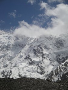
One of the mightiest peaks of the world, yes it is The NANGA PARBAT, situated in the north west frontier province of Pakistan.

I happened to be there a month ago, and it stunned me whole, with all its might and beauty, it was there standing infront of me, covered with layers of snow.

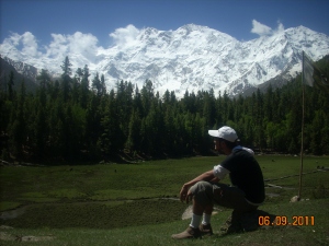
The LITTLE me hiking in front of the mightiness of the nanga parbat

The LITTLE me hiking in front of the mightiness of the nanga parbat

I went there with my university fellows Via FAIRY MEADOWS. We started our journey from Lahore, a city located in the province of Punjab, from there we reached CHALLAS after a tiring journey of 22hours. From there onward, the adventure started!

The famous Karakorum Highway

Raikot Bridge is situated a couple of hours from Challas, from there onwards an unforgettable JEEP SAFARI started.

On our way to TATTO village

Jeeps dropped us to TATTO village, and here we go, intense hiking and tracking started, We hiked on snow covered mountains, tracked between the darkest of forests, we passed the melting glaciers and frozen river, via FAIRY MEADOWS and BAYAL CAMP we reached there, in the heart of one of the highest mountains present in this world.

NANGA PARBAT’s BASE CAMP 0!!

BAYAL CAMP " the first base camp for the hikers"

Covered with snow and clouds. ( pic taken from bayal camp )

FAIRY MEADOWS "situated at the heart of NANGA PARBAT"

Frozen river and Breath taking glaciers

THE BASE CAMP 0 " HURRAAAAAAAAYYYYYYYYYYYY 🙂 "

we hiked and we tracked and kept ourselves motivated

Its been a month and still i am spell bounded by the beauty of NANGA PARBAT.